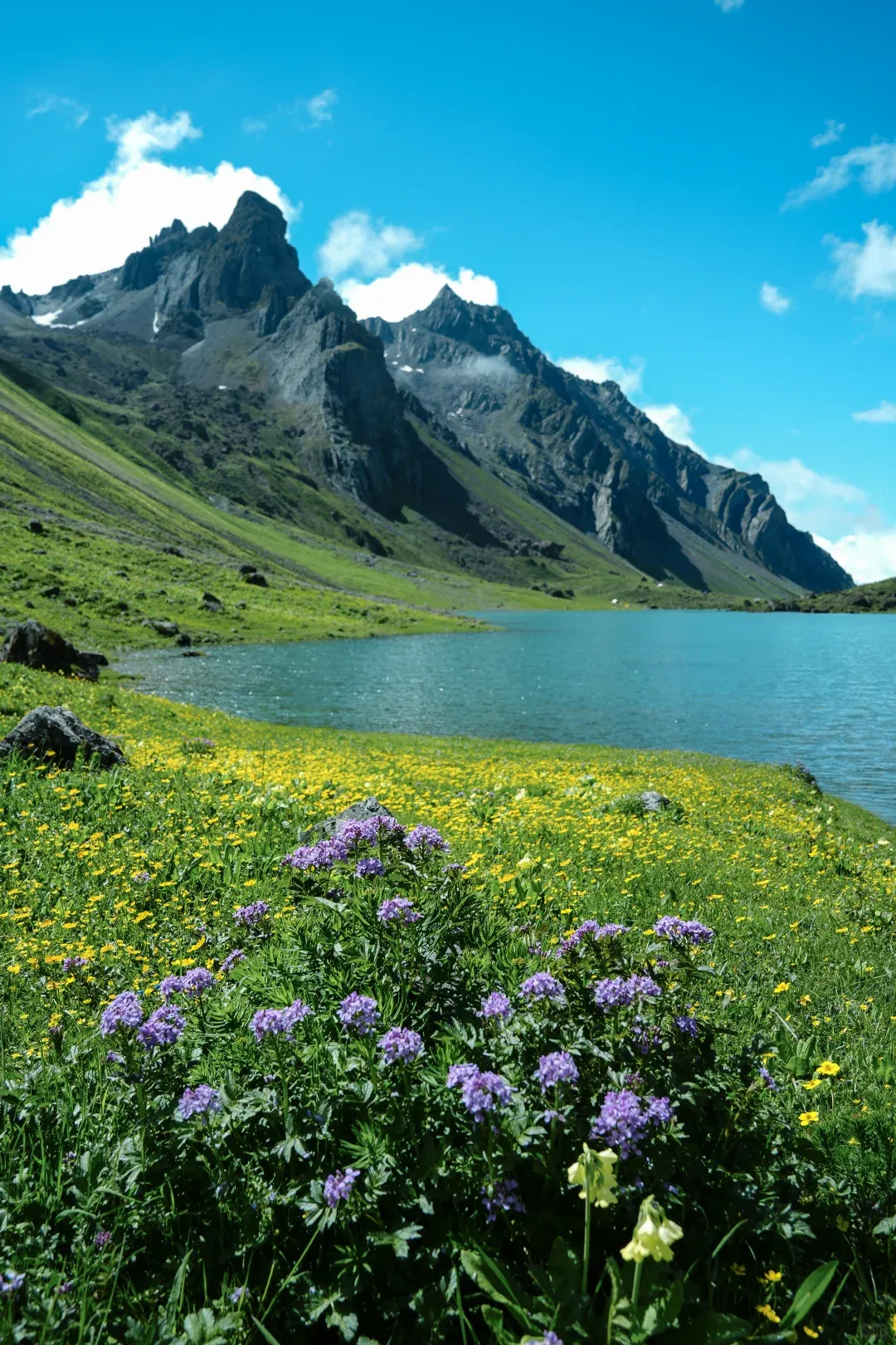
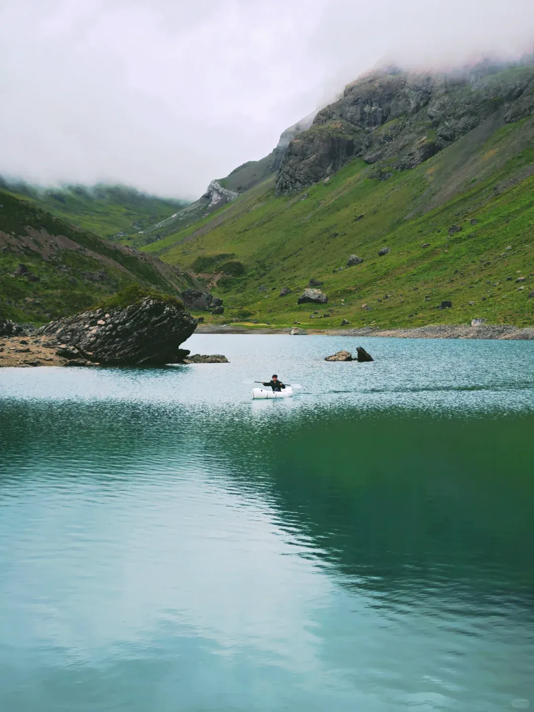
There's a word that keeps showing up in Chengdu hiking group chats every June: 豪赌 — "the big gamble." It means driving four-plus hours into the mountains west of Chengdu on the strength of a weather forecast, betting a whole weekend that the clouds will part. The prize, if you win, is Changhaizi (长海子): a gourd-shaped alpine lake at 4,100 meters whose water shifts from Tiffany blue to deep jade, sitting in a U-shaped valley that spends June and July buried in wildflowers.
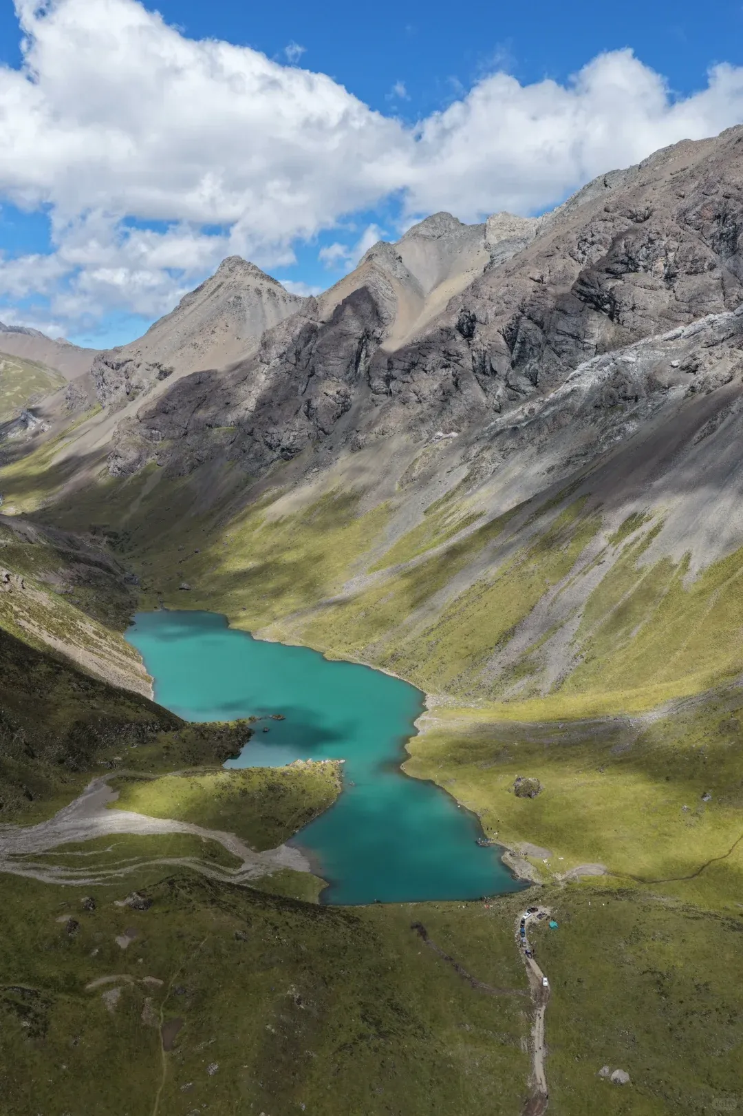
For the past two summers this lake has been quietly taking over Chinese social media. And here's the part that matters for you: it's one of the easiest 4,000-meter-class hikes anywhere near Chengdu. Twelve kilometers round trip, about 400 meters of climbing, on a farm track so gentle that complete beginners finish it in four to five hours — with marmots popping out of burrows along the way.
You will not find Changhaizi in any English guidebook — which is the story of Sichuan hiking in general. This guide pulls together what Chinese hikers actually reported from the trail across the 2025 and 2026 seasons — the fee system, the shuttle trick, the rule changes, the flower calendar — so you can do it without reading a word of Mandarin.
Why hiking in Sichuan never makes the English guides
The international China circuit is Beijing, Xi'an, Shanghai, Guilin — maybe Chengdu for pandas. The mountains that rise west of Chengdu, from 500 meters in the basin to 4,000-plus meters of Tibetan-plateau terrain within a half-day drive, almost never make the cut. The signage is in Chinese, the guesthouses live on Chinese booking apps, and nobody is writing about these trails in English.
That gap is marketing, not difficulty. Hiking in Sichuan spans everything from stroller-flat valley walks to serious mountaineering, and Changhaizi sits at the friendly end: no permits, no technical terrain, no multi-day commitment. The only real barriers are knowing where it is and handling a few China-specific logistics. Both are solvable in one read.
Which Changhaizi? Don't navigate to the wrong lake
First trap: Western Sichuan has several lakes called Changhaizi ("long lake" — it's a generic name, the way the Alps are full of Lac Longs). Even Chinese hikers regularly ask which one is which.
The one in this guide sits along the Baojin Line (宝金线) — the mountain road connecting Baoxing County (宝兴县, in Ya'an) with Xiaojin County (小金县, in Aba Prefecture) — right around the county border, up a side valley about 6 km off the road.
Navigate like this: from Chengdu, head to Baoxing County town, then Zhonggang Village (中岗村), then set your final waypoint to 继红藏家院 (Jihong Tibetan Homestay). That last name is the one that matters — it's the de facto trailhead base, and it's what every hiker around here actually types into the map app. From Zhonggang Village the road climbs another hour over a pass before the trailhead track branches off the main road.
The full drive from Chengdu is roughly 290 km and takes 4–5 hours.
The trail: 12 km that anyone can walk
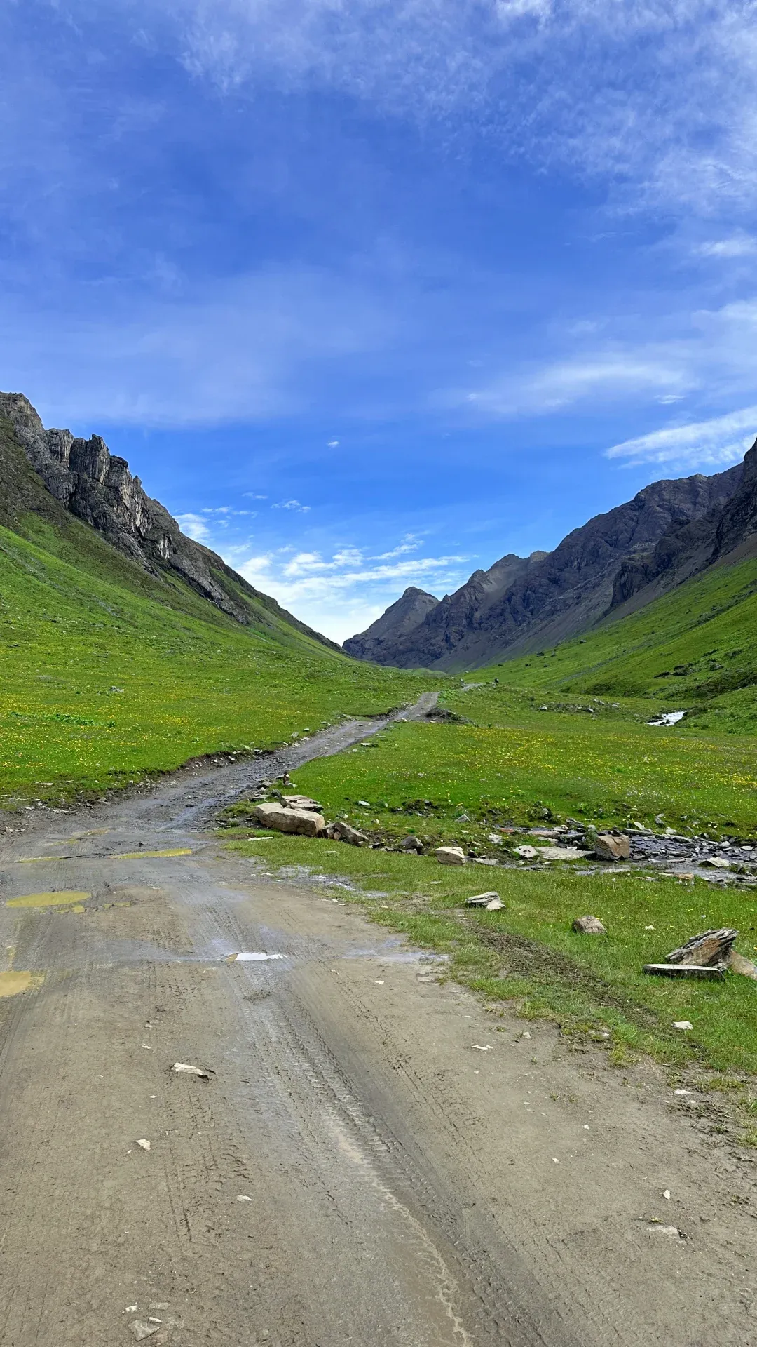
The numbers, cross-checked across two seasons of trip reports:
- Distance: ~6 km each way, 12 km round trip, out-and-back
- Elevation: trailhead around 3,600–3,700 m, lake at ~4,100 m — roughly 400 m of gain
- Terrain: a dirt farm track and gentle pasture path the whole way; no scrambling, no exposure
- Time: 4–5 hours round trip at a relaxed, photo-heavy pace
- Phone signal: none on the trail. The village has coverage; the mountain doesn't. Download offline maps before you go.
The route follows a stream valley the entire way up: a creek-and-wildflower section first, then open meadows where marmots graze (they're used to people and will absolutely investigate your snacks), then a final rise onto the lake basin where the turquoise water suddenly fills your whole field of view.
You'll pass through three livestock gates on the way. Close every gate behind you — they keep the yaks and cattle where the herders want them, and leaving one open is the fastest way to sour relations between hikers and the village.
If you have energy left at the lake, the ridge on the right side of the basin can be climbed for a full bird's-eye view of the water — a perspective most day visitors never bother with.
Getting there when you can't just drive
Here's the honest logistics picture for a foreign visitor:
There is no public transport. None. No bus reaches Zhonggang Village or the trailhead.
Self-driving works if you're licensed to drive in China (which, note, requires a Chinese license — an International Driving Permit is not valid here). The road is paved except the final stretch, but it's narrow with relentless hairpins. A sedan makes it if driven slowly; an SUV is the comfortable choice; a nervous mountain driver should not be the one behind the wheel.
Group tours are the realistic option for most foreigners. Chengdu and Chongqing outdoor operators run two-day Changhaizi trips every summer weekend for around ¥398 (~$55) per person, transport and lodging included. They're aimed at domestic hikers, so expect the trip to run in Chinese — but hiking is hiking, and the logistics (the hard part) are entirely handled. If you're in Chengdu, any outdoor shop or your hotel can help you find that weekend's departure; the trips are heavily advertised on Chinese social apps.
Note for international visitors: the mountain guesthouses around the trailhead don't exist on Booking.com or Trip.com — they live on Chinese apps or nowhere at all. If you're overnighting independently, the workable plan is a hotel in Baoxing County town (about two hours below the trailhead, real hotels, findable on Trip.com) or simply navigating to 继红藏家院 and taking a room on arrival. Village rooms run around ¥100 (~$14) a night.
One visa detail: if you entered China on the 240-hour visa-free transit, be aware this valley sits on the border between Ya'an (inside the transit policy's permitted zone) and Aba prefecture (outside it). On a regular visa or a 30-day visa-free entry there's no issue.
The ¥30 fee, decoded
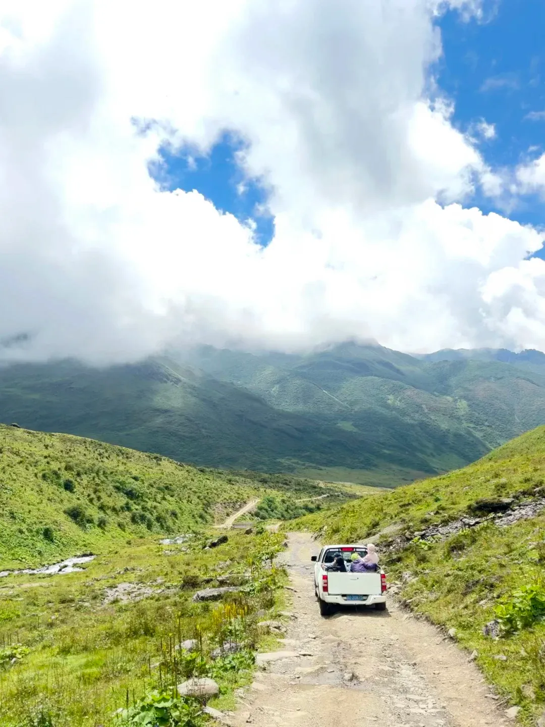
Changhaizi has no entry ticket. What it has is a ¥30 per person "cleaning fee", collected on the spot, no exemptions. Pay it without grumbling — here's why it's actually the best deal on the mountain:
The fee includes a free pickup-truck shuttle covering the ~4 km between the homestay and the trailhead proper, both directions. You ride in the truck bed through flower meadows. It's bumpy and it's great.
If 12 km sounds like too much, villagers also run pickups all the way to the lake. Pricing floats with the season and demand — reports range from ¥30 per person one way in quieter periods, to ¥150–300 to charter a whole truck, with peak holiday weekends seeing per-person prices spike far higher along with time limits at the lake. If you're visiting on a summer weekend, budget flexibility and go early.
When to go: the flower calendar and the weather gamble
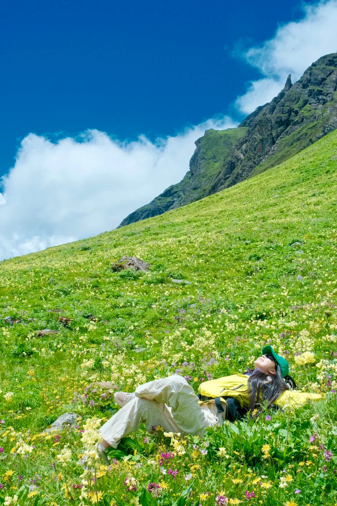
The season is short and specific:
- Mid-June to mid-July is prime time. By mid-June the meadows are already full of marsh marigolds and primulas — plus, if you're lucky, the blue poppy (绿绒蒿), the near-mythical Himalayan flower that Chinese hikers treat like a celebrity sighting. Locals say the bloom peaks around mid-July.
- By early August the flower show fades. The lake stays beautiful, but the meadows go plain green.
- Late September is too late for flowers entirely, though you'll have the trail nearly to yourself and daytime temperatures around 20°C.
Then there's the gamble itself. This valley makes its own weather, and the difference between a clear day and a socked-in day is the difference between the best photos of your year and hiking inside a wet cloud. The local strategy, proven across many attempts: watch the forecast and go on the first day after a stretch of consecutive clear days. People have left Chongqing at 6 p.m. on a Friday on the strength of a good forecast, hiked in sunshine Saturday morning, and watched the rain arrive that same afternoon. Timing is everything here.
Summer temperatures: 10–20°C in daytime sun, single digits at night. The day-night swing is brutal — pack accordingly.
The rules changed in 2025 — here's the current deal
This is where most older posts (and any machine-translated Chinese content you might find) will mislead you:
- Camping at the lake is banned, as of around August 2025. Earlier that summer it was still allowed, so photos of lakeside tents are everywhere online — don't plan around them. Word on the trail is the ban may lift once mobile coverage reaches the lake, but treat that as rumor.
- Private vehicles and motorbikes can no longer drive to the lake. The village shuttle or your own legs are the only ways in.
- Paddling is still allowed. Hikers carry inflatable packrafts and paddleboards up and float on water so still it mirrors the valley walls. If you own a packraft, this is the trip for it.
What to pack, and a word about altitude
Clothing: quick-dry base layer plus a windproof shell is the uniform; add a fleece for morning and evening. Mid-cut waterproof hiking boots handle the gravel track best. Trekking poles help more than you'd expect on the long gentle descent.
Altitude is the real risk, not the trail. The lake sits at 4,100 m, and if you drive in, you gain over 2,000 vertical meters of road elevation in about an hour — from 1,700 m at Zhonggang Village to 3,800 m at the pass. That's fast. Take it seriously: consider starting altitude medication a couple of days before, don't run around celebrating the moment you arrive, and use the gentle lower trail to warm up slowly. A mild headache on your first night up high is normal; a worsening one on day two means descend.
Also bring: sunscreen, sunglasses and a sun hat (the UV at 4,000 m is vicious), a thermos, a packed lunch and snacks — nothing is sold on the mountain — and a trash bag. The trail's sudden popularity has brought a litter problem, and the unwritten rule among hikers here is simple: carry out everything you carried in.
FAQ
Can I do it as a day trip from Chengdu?
Yes, if you start brutally early — people leave Chengdu at 4 a.m. and make it back the same night. It's a long day: 8–10 hours of driving wrapped around a 4–5 hour hike. The saner plan is 1.5 or 2 days with a night in Baoxing County town or at the trailhead village.
Do I really have to pay the ¥30 fee if I don't use the shuttle?
Treat it as mandatory. The trailhead is on a roadside where you can't park anyway, and the fee includes the shuttle that solves that exact problem. Thirty yuan for parking, shuttle, and trail upkeep is the best value on the mountain.
Can a regular sedan or a low-clearance EV make it?
To the trailhead homestay, yes — driven slowly and carefully. The road is paved but narrow with endless switchbacks. If you have the choice, take an SUV; if you're not comfortable on mountain roads, take a tour instead.
Is there phone signal?
In the village, yes. On the trail and at the lake, no. Download offline maps, tell someone your plan, and enjoy the disconnection.
How cold does it get?
Summer days in the sun are pleasant — 10 to 20°C, warm enough that people hike in t-shirts and pose for photos in summer clothes. But nights drop to a few degrees above freezing even in July, and the lakeshore wind bites. Layers, always.
When exactly are the flowers best?
Mid-June through mid-July, peaking around the middle of July. Early August is already past prime; late September has none.
Can I camp overnight at the lake?
Not currently — the ban has been in effect since August 2025. Base yourself at the trailhead village instead; overnight group tours usually include a bonfire evening there.
What's the food situation?
Bring your own trail food — there are zero services past the village. In the village itself, expect simple, cheap eats: a bowl of noodles or wontons for around ¥15, instant noodles for ¥8. Stock up properly in Baoxing County town on the way in.
Changhaizi is the easiest entry point into hiking in Sichuan, but it's exactly that — an entry point. The same mountains hide multi-day treks, 6,000-meter ice peaks, and grassland roads that go on forever. If you'd rather see this plateau on wheels than on foot, start with how Chengdu locals ride motorcycles to the Tibetan plateau on a weekend — same mountains, very different trip.
Continue planning
- Basing out of Chengdu? The Perfect 3-Day Chengdu Itinerary covers the city side of the trip
- Back to the Chengdu destination overview